The Future of Surveying: How Technology is Transforming the Industry
The surveying profession has a long and storied history, but it is also a field that continuously evolves. With the rapid development of technology, surveying has entered an era of transformation that is reshaping the way surveyors operate, how data is collected and analyzed, and the role of surveyors in modern society. From drones to artificial intelligence, the following are the key technologies driving the future of surveying.
1. Drones and UAVs in Surveying
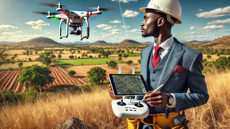
Drones, also known as Unmanned Aerial Vehicles (UAVs), have become a game-changer in surveying. They provide surveyors with the ability to capture aerial data quickly and safely, especially in hard-to-reach or hazardous areas. Drones equipped with high-resolution cameras and LiDAR sensors can collect detailed spatial data and produce accurate maps, even in complex terrains.
- Benefits: Faster data collection, reduced costs, safer operations in dangerous areas.
- Applications: Land mapping, infrastructure inspections, environmental monitoring, and agricultural surveys.
2. LiDAR and 3D Laser Scanning
LiDAR (Light Detection and Ranging) technology allows surveyors to measure distances by illuminating a target with laser light and measuring the reflected pulses with a sensor. LiDAR is widely used for creating high-resolution maps, 3D models, and topographic surveys.
- Benefits: Extreme accuracy, ability to capture data over large areas.
- Applications: City planning, archaeological mapping, forestry management, and flood risk analysis.
3. Geographic Information Systems (GIS)
GIS technology has become essential for modern surveyors. By integrating spatial data with mapping software, GIS allows surveyors to visualize and analyze information related to geographic areas, land features, and population data. It enables layering of data points to produce comprehensive, insightful maps.
- Benefits: Enhanced data analysis, easy access to layered data, real-time data updating.
- Applications: Urban planning, environmental impact analysis, and disaster management.
4. Real-Time Kinematic (RTK) GPS
RTK GPS is a satellite navigation technology that enhances the precision of position data derived from satellite-based positioning systems. RTK provides real-time correction of GPS signals, allowing surveyors to achieve centimeter-level accuracy.
- Benefits: Real-time, highly accurate location data.
- Applications: Construction, engineering, land development, and agricultural mapping.
5. Artificial Intelligence (AI) and Machine Learning
AI and machine learning are helping surveyors manage and analyze large datasets more effectively. AI can automate repetitive tasks, detect patterns in data, and improve data accuracy. For instance, AI algorithms can help in identifying land features, classifying terrains, and detecting changes in landscapes over time.
- Benefits: Faster data processing, improved accuracy, automation of routine tasks.
- Applications: Predictive mapping, automated data analysis, and real-time decision-making.
6. Building Information Modeling (BIM)
Building Information Modeling (BIM) is revolutionizing construction surveying. BIM involves creating a digital representation of a physical building or infrastructure, allowing surveyors and construction professionals to collaborate on projects seamlessly. This technology ensures that all project stakeholders have access to accurate, up-to-date information.
- Benefits: Streamlined collaboration, accurate project planning, minimized rework.
- Applications: Construction project management, structural assessments, and facility management.
7. The Internet of Things (IoT)
The Internet of Things (IoT) involves connecting physical devices to the internet to collect and exchange data. In surveying, IoT devices can be used to monitor environmental conditions, track the status of surveying equipment, and ensure data integrity by providing real-time updates.
- Benefits: Continuous monitoring, increased data accuracy, remote access to data.
- Applications: Environmental monitoring, equipment management, and infrastructure assessment.
The Future Outlook
The integration of these technologies has brought immense value to surveying, making it more precise, efficient, and accessible. The future of surveying will likely involve even greater advancements, including automation, increased use of virtual and augmented reality, and enhanced data security. These technologies will continue to open new doors for surveyors, allowing them to deliver high-quality services while meeting the growing demands of modern society.
As technology continues to advance, surveyors will play an essential role in shaping and understanding our world in ways never before imagined. For those in the field, the journey ahead is one of excitement, innovation, and opportunity.


